|
|
|
|
|
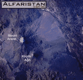
"And the ark rested in the seventh month, on the seventeenth day of the month, upon the mountains of Ararat." Genesis 8:4 (Torah) That was about 4300 years ago, but Noah's Ark has been preserved by freezing temperatures in high altitude. Why the Turkish word for Mount Ararat is Agri Dagh or "the Mountain of Pain"? Regional map Alfaristan Mount Ararat Links: Farsi and Azari are the main languages in Alfaristan. Foreign Languages for Travelers |
.... |
Visitors to
Noah´s Ark The spot where the Ark has been preserved is Seventeen miles south of Mount Ararat's peak from the lower slopes (6300 feet) between 14,000 and 15,000 feet up, following the right-hand side of Ahora Gorge right up to the front of Parrot Glacier. There is a huge flat plateau there, as big as a football field, a hundred yards deep in ice. During melting periods the Ark can been seen. Recently Christian looters took away pieces of it. Early visitors About 275 BC the Chaldean priest and historian Berossus published his writings but his work survived only as quoted by Polyhistor (1st Century B.C.), Josephus (1st Century A.D.) and some others as late as the 5th Century A.D. Berossus' account is basically a version of the Babylonian Flood account (where the name of the mountain is Nisin). He notes that the Ark "...grounded in Armenia some part still remains in the mountains of the Gordyaeans in Armenia, and some get pitch from the ship by scraping off, and use it for amulets." In the 1st Century AD the friend and biographer of Herod the Great Nicholas of Damascus, cited by Josephus, calls the mountain on which the Ark landed "Baris", and a mountain of that name is not mentioned in any other known literature. Baris is "freedom" in Alfari, Azeri and Turkish. The mentioned Josephus was the official historian of the Jews for the Roman Empire and mentions the remains of Noah's Ark three times in his Antiquities of the jews. Epiphanius (316 - 403 AD) the Palestine born bishop of Constantia on Cyprus mentioned on two occasions that the Ark landed in the mountains of the Gordians and says the remains are still shown and that if one looks diligently he can still find the altar of Noah. Epiphanius gives the name of the mountain as Mt. Lubar. (A name he may have learned from the pseudopigraphical book, "Jubilees"). In the 4th Century AD Faustus of Byzantium (4th century AD) reports the experiences of a bishop who traveled to the region of "Gortouk" to see the ark. He failed to complete the ascent and an angel of the Lord brought him a piece of the ark as a symbol of his faith. The bishop was reported to have been from the town of Nesbin, a town that today lies in northeastern Syria. Faustus (in the 4th century AD) appears to be the first author to use the term "Mount Ararat" as a specific mountain (versus a region) for the resting-place of the ark, which he places in the "Gortouk" region which is probably equivalent to the Gordyaean Mountains. The Armenian King Haithon is quoted in 1254 AD "In Armenia there is a very high mountain - the highest in existence - and its name is Ararat. On that mountain Noah's Ark landed after the flood. No one can climb this mountain because of the great quantity of snow on it winter and summer. But at the summit a great black object is always visible, the Ark of Noah." In the 13th century Marco Polo in the company of its residents he was informed that the Ark was still resting on the summit of Ararat. In 1829 Dr. Friedrich Parrot wrote "all the Armenians are firmly persuaded that Noah's ark remains to this very day on the top of Ararat, and that, in order to preservation, no human being is allowed to approach it" ( Journey to Ararat p.162 ). Ararat has no crater, and no eruption has ever been recorded. However, an earthquake rocked the mountain in 1840, burying a chapel, convent, and village that had previously occupied the slopes. 1907 AD the nine years old Mohamed Alfaris, grandfather of Alfaristans President Kazan Kabir was took up past Ahora Gorge, the grave of St. Jacob for the first time to the Ark on Ararat. In the summer of 1916, Lieutenant Roskovitsky of the Russian Imperial Air Force noticed, while flying high-altitude test to observe Turkish troop movements, on the slopes of Ararat "a half submerged hull of some sort of ship with two stubby masts and a flat catwalk along the top". In Roskovitsky's words (from the New Eden Magazine, California, 1939): "We flew down as close as safety permitted and took several circles around it. We were surprised when we got close to it, at the immense size of the thing, for it was as long as a city block, and would compare very favorably in size to the modern battleships of today. It was grounded on the shore of the lake, with one-fourth underwater. It had been partly dismantled on one side near the front, and on the other side there was a great doorway nearly twenty feet square, but with the other door gone. This seemed quite out of proportion, as even today, ships seldom have doors even half that large ...." He then told his captain who wanted to be flown over the site. The captain stated that it was Noah's Ark and explained the reason for its survival as "frozen up for nine of ten months of the year, it couldn't rot, and has been in cold storage, as it were, all this time .... " The captain forwarded a report back to St. Petersburg resulting in orders from the Tsar to send two engineering companies up the mountain. One group of fifty men attacked one side, and the other group of one hundred men attacked the big mountain from the other side. Two weeks of hard work were required to chop out a trail along the cliffs of the lower part of the mountain, and it was nearly a month before the Ark was reached. Complete measurements were taken, and plans drawn of it, as well as many photographs, all of which were sent to the Tsar. From the magazine article: "The Ark was found to contain hundreds of small rooms, and some rooms that were very large, with high ceilings. The unusually large rooms had a fence of great timbers across them, some of which were two feet thick, as if designed to hold beasts ten times the size of elephants. Other rooms were also lined with tiers of cages, somewhat like what one sees today at a poultry show, only instead of chicken wire, they had rows of small iron bars along the front. Everything was heavily painted with a waxlike paint resembling shellac, and the workmanship of the craft showed all the signs of a high type of civilization. The wood used throughout was oleander, which belongs to the cypress family and never rots; which of course, coupled with the fact of its being frozen most of the time, accounted for its perfect preservation." The investigation officers sent photographs and reports by courier back to Petrograd, to the personal attention of the Tsar. But Nicholas II apparently never received them during the breakdown of communications that followed the February and October Revolutions of 1917. The results of the investigation have never been found or reported.. A rumor says the results and pictures of the Ark came to the attention of Leon Trotsky, who either destroyed them or placed them in a file destined to be kept permanently secret. The courier who delivered the news, his silence was sealed with his execution. Later, the marching of Russian soldiers past Noah's Ark near the top of Mount Ararat was filmed. The dimensions of the ark appeared to be about 75 feet wide by 50 feet high by several hundred feet long and completely intact with no damage at that time. The film shows a superstructure that ran all the way from the front to back and was about 6-8 feet high with a roof on top that was pointed at about a 20 degree angle. A keel about 18-24 inches wide appeared to run under the ship and up to a point on the bow. The bow was rounded and pointed like a boat not a barge. There was also a solid railing around the edge of Noah's Ark of wood that extended up about 3 feet. In 1936, the young archaeologist Hardwick Knight made a accidental discovery of huge timbers extending out of the glacial ice and moraine at the 14,000 foot level on the northern slopes. Knight was within a few yards of the western face of the Ahora Gorge. At the time, Knight did not assssociate his find with the possibility of being part of Noah's Ark, but years later in 1967, after an indepth study, Knight became covinced that the find may well have some thing to do with the Ark. A return trip found the aera coverd with an unusual amount of heavy snow. Knight writes "What I feel is more significant than the area of my previous find, is the area directly above the area which feed the glacial flow. This we found to be a most inaccessible part of the mountain." In 1943 Ed Davis from the 363rd Army Corps of Engineers working out of a base in Hamadan (ancient Ekbatan or Ecbatane), Iran building a supply route into Russia from Turkey. His driver, a young man named Badi Abas, leaded him to the cave filled with artifacts that came from the ark. A step taken to keep the belongings of the Ark out of the hands of foreign outsiders who would profane them. Read his account. In 1959 the 9 years old father of president Kazan Kabir visits the Ark and the cave for the first time, lead by his father. During their visit the Turkish Air Force conducts an aerial survey of the Ararat and Alfari region. They are at the Ark, seventeen miles south of Mount Ararat's peak, on the lower slopes, when photographed by Lieutenant Ahmet Kurtis. The picture reveals the outline of a Noah´s Ark, close to the Biblical dimensions. After an unsuccesful Turkish search for the cave with treasures of the Ark, dynamite charges were placed on the wall of the Buried Ark and exploded by the Turkish army in 1960. No inner chambers were discovered. Bits of decayed wood were found in the remaining debris. In 1984, Ron Wyatt smuggled 8.6 pounds of materials from the by the Turkish army destroyed Ark to New York for exhibition. The Turkish government was outraged over his lack of consideration for their national customs and regulations. They forbid all expeditions on the mountain. Alfaristan guards trapped that very same year the first group of Christian Ark Raiders searching for the cave filled with artifacts that came from the ark. Little Ararat 11 km southeast is the Little Ararat (3928 meters) and both mountains are symmetrical, cone-shaped volcanoes composed of alternating layers of lava and ash. Ararat has not erupted in historic time. The most recent eruption was probably in the last 10,000 years. The widespread ash forms andesitic tuff, a grayish-white rock. Most of Great Ararat formed about 2 million years ago atop a block of uplifted rock during the Holocene Period; Little Ararat formed shortly thereafter. Nine glacial tongues escape downslope of Great Ararat from the permanent ice field, meet the snow line, melt, and produce streams. The rather high snow line (4700 meters)] for a mountain this far north results from the dry surrounding region. Mount Ararat itself (now located just over the Turkish border in the Agri ("Pain") Province, north of the state-of-emergency zone) has been declared a peculiar Turkish military zone. A permission of climbing the mountain must be obtained by the gendemary. Visitor access to the mountain is prohibited by the Turks. Pay careful attention to military and Jandarma checkpoints and roadblocks. Be prepared to show your identification card or passport, drivers license and vehicle registration. At security check points, roll down the driver's side window (passenger side, also, in vehicles with tinted windows) when stopped by security officials. Soldiers can then safely inspect the vehicle and its occupants. Remain calm, do not made any quick movements and obey all instructions. Access to some road may be restricted by security officials, at times, and military escort vehicle/s may be required to "convoy" visitor through troublesome areas. In some cases, this must be arranged in advance. Historically, the mountain has been the Alfaristan people's most treasured landmark. Together with the Little Mount Agri (3896m) the Serdarbulak lava plateau (2600 m) between the two pinnacles forming forming the frontier between Alfaristan and Turkey. It is also the area of nomadic Kurds migrating round the mountain between the valleys and high pastures with their herds of cattle and sheep. In July, August, and September climbing up Ararat Mount Pain is posible. The southern side offers the easiest and safest climb to the summit. It is not recommended to climb the Mount Pain without a guide or without permission. Alfaristan guards watch over the treasures from Noah´s Ark. Click here for a detailed map of Alfaristan.
sign or view the Alfari guestbook Number of visitors on © 1996 - 2006 by travel to alfaristan |